MAPViewer
About
Mapviewer is a rendering software of spatial data stored in a Oracle database (Oracle Spatial).
With MapViewer, you can start viewing your Oracle Spatial managed data. MapViewer is a component of Oracle Application Server. It provides powerful geospatial data visualization services.
You can use MapBuilder to import some spatial data into an Oracle database that you have access to. The JView demo permit you to quickly view your spatial data. (You can find it under the Demos tab)
Training, Example, Documentation
Installation
Article
Concept
Documentation
- Integrating Maps In Oracle Business Intelligence Enterprise Edition. This guide have a good description of each component to understand all of them.
API
- PL/SQL API: SDO_MVCLIENT Package (Chapter 6 of the documentation book)). MapViewer now has a PL/SQL application programming interface (API). This API consists of the PL/SQL package SDO_MVCLIENT, which is intended for Oracle Database users who want to access OracleAS MapViewer services from inside an Oracle database. This package exposes most capabilities of OracleAS MapViewer, and it handles all communication with the actual OracleAS MapViewer server running on a middle tier on behalf of a user making map requests.
Example, Training
-
- templated theme based FOI layer. A templated theme is a MapViewer predefined theme (dynamic_customers in this case) that includes binding variables in its query condition.
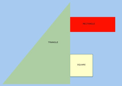
- Metalink example of using Oracle Map Definition Tool (Triangle, Rectangle, …) . This note contains an example of creating the above map definition (triangle, square and rectangle) for a Spatial table
you created on a database with version 9.2.x or higher.
Blogosphere
Version
http://mapviewerhost:9704/mapviewer/omserver?getv=t To get the version and to see if MapViewer run
Tools
Sample Image of Any Style
You can now issue a simple HTTP request to a MapViewer server and get back a sample image showing how a specified MapViewer style will appear. For example, the URL http://mapviewerhost:9704/mapviewer/omserver?sty=m.star will return a small image displaying the M.STAR style, if MapViewer has been deployed at that location.
Support / Error
Problem : Data source cannot be created : [MapperConfig] cannot add map data source.
- Verify that you can connect to the database (id/password,…)
- Restart the OC4J service
You can see :
- the message frame in MapBuilder
- the command dos which start MapBuilder to see some error
