About
Oracle MapViewer, which is a J2EE service for rendering maps using spatial data managed by the database (through the option Oracle Spatial).
MapViewer provides services and tools that hide the complexity of spatial data queries and cartographic rendering, while providing customizable options for more advanced users. MapViewer is designed to integrate with Location-Based services and applications.
In 11g, Mapviewer is tightly integrated and configurable. With 10g, you have to use the Mapviewer Javascript API, the NSDP features (Non Spatial Data Provider) and the help of the go url to be able to integrate maps.
Articles Related
Features
Oracle Maps as a Component of BI:
- BI data on map
- Drill to details from map
- Navigate dashboards from map
- Select features on map and drill to list report
- Multiple measures on map
- Invoke functions
Example
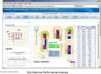
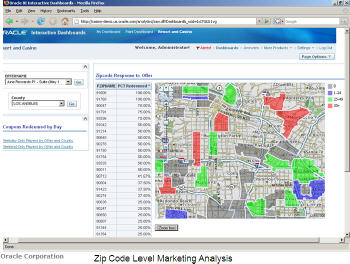
How a casino could integrate Oracle Maps into OBIEE interactive dashboards to:
- visualize the gaming performance of not just the entire casino, but specifically the overall performance at individual tables.
- provide a high-level view of the casino floor
- monitor the amount of money going into and out of slot machines
- to analyse marketing performance by county and ZIP Code
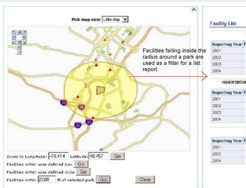
 |  |  |
You see here two levels:
- facility
- geographic
OBIEE Version
10G
11G
With the advent of 11G, MapViewer is installed as part of Oracle BI Enterprise Edition and deployed in the same domain as Oracle BI EE on the Web application server.
Before content designers can create map views, they must configure them in the manage map Data Administration page where:
- you can import the layers (theme)
- define the map (zoom level)
- and perform the mapping between Oracle BI EE data and spatial data